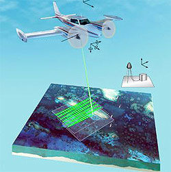
 The mission of the Joint Airborne Lidar Bathymetry Technical Center of Expertise (JALBTCX) is to perform operations, research, and development in airborne lidar bathymetry and complementary technologies to support the coastal mapping and charting requirements of the U.S. Army Corps of Engineers, the U.S. Naval Meteorology and Oceanography Command, and the National Oceanic and Atmospheric Administration (NOAA). JALBTCX staff includes engineers, scientists, hydrographers, and technicians from the Army Corps of Engineers Mobile District, the Naval Oceanographic Office (NAVOCEANO), the Corps Engineer Research and Development Center (ERDC), and the NOAA National Geodetic Survey (GDS).
JALBTCX executes survey operations using the Compact Hydrographic Airborne Rapid Total Survey (CHARTS) system and industry-based coastal mapping and charting systems. CHARTS is our in-house survey capability that includes an Optech, Inc., SHOALS-3000 lidar instrument integrated with an Itres CASI-1500 hyperspectral imager. CHARTS collects either 20 kHz topographic lidar data or 3 kHz bathymetric lidar data, each concurrent with digital RGB and hyperspectral imagery. Survey operations support the Corps National Coastal Mapping Program and NAVOCEANO nautical charting missions. Survey personnel include contracted employees of Fugro Pelagos Inc.
JALBTCX research and development supports and leverages work in government, industry, and academics to advance airborne lidar and coastal mapping and charting technology and applications. Collaborations currently include the U.S. Geological Survey, NASA Wallops, U.S. Naval Research Lab, ERDC System Wide Water Research Program, NOAA NGS, Optech International, the Office of Naval Research, ERDC Topographic Engineering Center, the University of Southern Mississippi, the Ohio State University, the University of Florida, University of New Hampshire, and Duke University.