Coastal Resiliency Program

Who We Are

The story of the Coastal Resiliency Program began in the aftermath of Hurricane Katrina (2005) and its disastrous effects on the Gulf Coast.  After landfall, the United States Army Corps of Engineers (USACE), Mobile District began to assemble a specialized team that oversaw what would become the Mississippi Coastal Improvements Program (MSCIP), one of the largest system-wide coastal storm risk management programs in USACE. MSCIP utilized a system-wide approach to coastal risk reduction and fostered collaboration with partners and stakeholders to successfully address coastal storm damages. The program has evolved to include study, design, and construction efforts in coastal Mississippi, Alabama, and the Florida Panhandle. As a result of this growth, the program is now known as the Coastal Resiliency Program. Additionally, the program has worked to facilitate the meaningful inclusion of regional sediment management and natural and nature-based features into our projects, which has helped the Mobile District gain recognition as a Regional Sediment Management Implementation Champion and Engineering with Nature Proving Ground. 

What We Do

Coastal areas play an important role in the nation’s economy by supporting port commerce, tourism, valuable fisheries, critical habitat, and other major revenue streams for state and local governments. Coastal areas are also vulnerable to hazards posed by sea level change and coastal storms. Recent hurricane events have emphasized the increasing vulnerability of coastal areas to natural disasters through the combination of climate change, geological processes, and continued urbanization of our coastline. 

Our mission is to deliver vital engineering solutions, in collaboration with our partners, that reduce coastal storm risks and increase ecosystem and community resilience. We use an integrated approach that incorporates a system of measures that include natural and nature-based features, nonstructural and structural solutions.   

Improving resilience is a key objective of the USACE to reduce risk to our coastlines and nearshore communities while preserving and protecting the natural habitat. 

Building innovative, climate resilient infrastructure to protect communities and ecosystems can be achieved through natural or nature-based features such as wetlands, beaches and dunes; nonstructural interventions through updated policies, building codes and emergency response; and structural interventions such as seawalls and breakwaters.  

Coastal Storm Risk Management

The USACE coastal storm risk management mission area encompasses ongoing and diverse risk management projects, programs, and authorities, and includes engagement and partnerships with other Federal agencies and Tribal organizations. USACE activities related to coastal storm risk management include technical services, project planning, design and construction, levee safety, emergency operations, and emergency response. Coastal storm risk management projects utilize structural and nonstructural measures to manage the hazards associated with flooding and reduce the negative consequences to people and property.

Panama City Beach Coastal Storm Risk Management Project 2020 

The Panama City Beaches Coastal Storm Risk Management (CSRM) Project was originally authorized by Section 501(a) of the Water Resources Development Act (WRDA) of 1986 and reauthorized by Section 318 WRDA of 1996.The project was constructed between 1998 - 1999 for the eastern 16.5 miles and in 2011 for the western 1-mile stretch along Carillon Beach and Pinnacle Port. The authorized project restored the beach berm that sits near 6.5 feet in elevation along 17.5 miles of shoreline. The berm maintains a 50-foot top width and then transitions to a 30-foot top width before tying back into the natural shoreline. The authorized project provides periodic renourishment at an estimated 10-year interval. 

A high angle view of a beach

Description automatically generated with low confidence

Panama City Beach 2005-06Post Ivan and Katrina Nourishment 

Mississippi Barrier Islands Restoration 

The Mississippi barrier islands of Petit Bois, Horn, East Ship, West Ship, and Cat are dynamic landforms that act as the first line of defense between the Gulf of Mexico and the Mississippi mainland coast. The Offshore Barrier Island Restoration was authorized as a coastal storm risk management and ecosystem restoration project under the MSCIP Comprehensive Plan. The primary objectives were to maintain the estuarine ecosystem and resources of the Mississippi sound, preserve natural and cultural resources of the barrier islands, and restore their structure to reduce coastal storm damage impacts on the mainland. Restoring sediment and island structure is providing coastal storm damage reduction benefits to the mainland coast of Mississippi and restoring 1,150 acres of critical coastal zone habitats. This provides over 400 average annual functional habitat units and ensures sustainability of the Mississippi Sound ecosystem by maintaining salinity inflows from the Gulf of Mexico.

Timeline

Description automatically generated

Graphical user interface, map

Description automatically generated

Offshore Barrier Island Restoration Components 

An aerial view of a beach

Description automatically generated with medium confidence

Ship Island Phase 1 Construction  

Bay St. Louis Seawall 

The Bay St. Louis Seawall was originally constructed by local interest between 1915 and 1928 to protect the upland against erosion due to low to moderate waves. Hurricane Katrina (August 2005) with storm surge reaching upwards of 28 feet within the region caused significant damage that compromised the original structure. The Bay St. Louis Seawall Reconstruction Project was authorized as a coastal storm risk management project under the MSCIP Comprehensive Plan. The project purpose was to provide storm damage reduction benefits through reducing the frequency of road, utility, and real-estate property damage landward of the seawall. The project is located along the shoreline of the city of Bay St. Louis, Hancock County, Mississippi. The 2010-2014 reconstruction included  a new concrete stepped seawall and a storm water conveyance system. The seawall elements consist of an approximate 5,600 foot stepped concrete seawall founded on concrete piles.  Approximately 510 feet consists of a concrete tee wall with a vinyl sheet pile cutoff, and the remainder is a vinyl sheet pile wall with a concrete cap.  The top elevation of the new wall sections approximates the elevation of the reconstructed North Beach Boulevard roadway and ranges from approximately elevation 8.5 feet to elevation 22.5 feet.  The storm water system consists of inlets, culverts, and manholes, and conveys storm water runoff past the seawall to Mississippi Sound. The seawall required 16,000 cubic yards of concrete, 600 tons of reinforced steel, and 60,000 cubic yards of beach sand to provide protection at the base of the wall, which extends 6,500 feet south from HWY-90 along the shore of Bay St. Louis. 

A picture containing text, roadDescription automatically generated

Bay St. Louis Sea Wall Construction 


Aquatic Ecosystem Restoration

The ecosystem restoration mission area focuses on restoring degraded aquatic ecosystem structures, improving function and dynamic processes to a more natural condition, and employing system-wide watershed approaches to problem solving and management for ecosystem restoration projects. Our principal ecosystem restoration focus is on ecological resources and processes that are directly associated with, or directly dependent upon, the hydrological regime of the ecosystem and watershed(s). 

Franklin Creek Ecosystem Restoration

Hurricane Katrina (2005) caused rising waters in the Escatawpa River in Jackson County, Mississippi, near the Alabama-Mississippi state line resulting in large volumes of storm surge introduced into the system. This caused Franklin Creek to overflow its banks, which inundated numerous residences within the community due to the low ground elevations in the area. The project was authorized as a nonstructural coastal storm risk management and ecosystem restoration project under the MSCIP Comprehensive Plan to ensure the stability of the Grand Bay Pine Savannahs, enhance the productivity of the Grand Bay Marshes, and restore oyster reef habitat that once existed. Future work will include the restoration of hydrology and native hydrology by removing ditches, excavating and removing roadbeds, installing culverts under U.S. Highway 90, controlling non-native species, and controlled burning to restore 149 acres with critical pine savannah wetlands, which provide floodwater retention, groundwater recharge, and water purification. These elements will provide an increase of 516 average annual functional habitat units and restore the natural hydrology of the area. Risk reduction benefits would also extend from the removal of approximately 30 residential structures from the floodplain. 

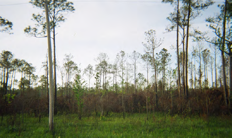
Wet pine Savannah habitat south of Old Stage Road. (Franklin Creek)

Bayou Caddy Aquatic Ecosystem Restoration 

Bayou Caddy was authorized as a Aquatic Ecosystem Restoration project under MSCIP Interim Report.  The project is an active dredged material placement site that uses a living shoreline approach to create salt marshes and restore wetland habitat. The dredged material placement and salt marsh restoration site is confined with geotubes. Prior to recent upgrades in 2013, there had been significant damage to the tubes (i.e., shifting and elevation loss) that lowered the site’s functionality. Specifically, the predominant wave induced current and sediment transport resulted in inadequate containment of the dredged material used for salt marsh substrate. The primary damage to the site was during Tropical Storm Lee in 2011, with additional damage from Hurricane Isaac in 2012. The tropical storms pushed the sand fill to the north end of each tube, packing and swelling that end while leaving the other end under-filled. Even during non-storm conditions, additional shifting of the geotubes occurred. As a result, USACE, replaced the geotube containment dike in 2013 and constructed an offshore breakwater to reduce wave energy in its lee. The intent is for the breakwater to buffer the geotube structure during critical water level and wave conditions for containment purposes and provide an additional level of erosion control for the restored wetlands after the geotubes have degraded. 


A body of water with land around it

Description automatically generated with low confidence

Bayou Caddy Aquatic Ecosystem Restoration Site 

Deer Island, Mississippi Aquatic Ecosystem Restoration Project

Located in the Mississippi Sound, Deer Island is a narrow, four-and-a-half-mile-long landmass that buffers the City of Biloxi from wind and wave energy. However, past coastal storms and hurricanes including Hurricane Katrina (2005) breached parts of the island, reduced elevations, eroded the beach, and impaired forested areas. The purpose of the Deer Island project is to restore the island and create long-term beneficial use capacity for material dredged from the nearby Biloxi Harbor Navigation Project. Additionally, the project will minimize the fracturing of biodiversity, and result in an additional 400 acres of highly productive estuarine wetlands, restored beach and dune habitat, reduced coastal erosion, and restoration of the coastal maritime forest.  

Restoration elements include the extension of the southeast island to a near 1850 footprint, restoration of island elevations and hydrology in existing marshes, and restoration of the maritime forest footprint on the island. In addition, the project is evaluating breakwater features that can enhance economic and habitat benefits that include reef habitat for fish and oysters and reduce wave energy in the lee to soften the effects of normal wave erosion of the island as well as provide expanded areas in the lee that can support the State’s off bottom oyster aquiculture industry.  Overall, the project once complete is estimated to produce an increase of 2,125 average annual functional habitat units. The city of Biloxi will also regain a stronger buffer from storm events, an area better suited for recreation, an increase in related business opportunities for the local community, and a cost-effective and environmentally acceptable beneficial use site for placement of dredged material.  A high angle view of a beach

Description automatically generated with low confidence

Deer Island, Mississippi Aquatic Ecosystem Restoration Site


Regional Sediment Management, Engineering with Nature

Regional Sediment Management (RSM)

RSM is a USACE initiative to support a systems approach using best management practices for more efficient and effective use of sediments in coastal, estuarine, and inland environments to promote healthy systems.   

Additional information on the USACE RSM program can be found at the link below: 

https://rsm-usace.hub.arcgis.com/ 

Engineering with Nature (EWIN)

EWN is an USACE initiative for the intentional alignment of natural and engineering processes to deliver economic, environmental, and social benefits sustainably. Incorporating natural and nature-based features into project scoping, design, and construction – from a foundation of inclusive and collaborative engagement – creates a broad array of opportunities to strengthen community resilience into the future

“We absolutely want to do more engineering with nature everywhere we work across the Corps, you have my commitment”

Additional information on the USACE Engineering with Nature Program can be found at the link below: 

https://coastal.la.gov/wp-content/uploads/2023/01/230105_CPRA_MP-Draft_Final-for-web_spreads-main.pdf

Coastal Resiliency Studies

South Atlantic Coastal Study (SACS)

Section 1204 of WRDA 2016 authorized the Secretary of the Army to conduct a comprehensive coastal study within the geographic boundaries of the South Atlantic Division (SAD) to identify the risks and vulnerabilities of those areas to increased hurricane and storm damage as a result of sea level rise.  In addition, the authorization, required the study to recommend measures that could address the vulnerabilities and identify opportunities and long-term strategies that enhance resiliency, increase sustainability, and lower risks to populated areas, concentrated economic development, and vulnerable environmental resources. The SACS was a response to this authorization. The study area included the tidally influenced coastal regions of Alabama, Florida, Georgia, Mississippi, North Carolina, Puerto Rico and the U.S. Virgin Islands. In addition to regional analyses of coastal vulnerability, the SACS identified initial measures/costs that if implemented could address vulnerabilities with emphasis on regional sediment management as an actionable strategy to sustainably maintain or enhance current levels of storm protection. 

Alabama Coastal Comprehensive Plan (ACCP)

The Alabama Coastal Comprehensive Plan (ACCP) is a proactive and stakeholder-driven planning tool commissioned by the State of Alabama's Department of Conservation and Natural Resources.  The ACCP planning process was designed to facilitate a greater understanding of the dynamic social, environmental, and economic landscapes that comprise the Coastal Alabama community. The State and its partners are working with stakeholders to determine where opportunities exist to make impactful improvements across multiple community sectors in support of our Coastal Alabama values.  Objectives include developing a high-level planning tool for the State of Alabama that: 

  • Identifies the public’s social, economic, and environmental visions for Mobile and Baldwin Counties. 

  • Highlights existing plans and strategies that support those visions and promote resilience across the coastal communities. 

  • Identifies areas vulnerable to sea level change and coastal storms and characterizes the resilience of the area (i.e., the ability to prepare and plan for, absorb, recover from, and successfully adapt to adverse events). 

  • Identifies opportunities to further develop the resilience of the region. 

Alabama Barrier Island Restoration Assessment

The Alabama Barrier Island Restoration Assessment was a science-based, collaborative effort between the State of Alabama, U.S. Geological Survey (USGS), and the U.S. Army Corps of Engineers (USACE) to investigate viable options for the restoration of Dauphin Island that if implemented could increase island sustainability and restore vital habitats for species affected by the 2010 Deepwater Horizon (DWH) oil spill. Dauphin Island plays an important role in the protection of the State of Alabama’s coastal natural resources, and like its neighboring islands in Mississippi, serves as the first line of defense in reducing storm impacts to the mainland coast. The results of this study demonstrate that restoration measures have the potential to enhance the ecological resiliency and structure of the island. While no measure eliminates the hazard, these science-based assessments suggest the implementation of various measures, combined with a targeted monitoring and adaptive management strategy, could enhance the island's ability to absorb, adapt, and recover to potential future events over the next several decades. 


A picture containing outdoor, grass, sky, plant

Description automatically generated

Dune Restoration

Mississippi Coastal Improvements Program (MSCIP)

MSCIP is the largest authorized system-wide coastal storm risk management program in USACE, integrating nonstructural solutions, such as voluntary buyouts in high-risk areas, and use of natural features, such as marshes and barrier islands, for risk reduction. MSCIP used comprehensive planning to address hurricane and storm damage reduction; saltwater intrusion; shoreline erosion; fish and wildlife preservation; and other water-related resource projects. In addition, the comprehensive planning was to be consistent to the maximum extent possible with the State Coastal Restoration Plan.

Document Library can be found here.

Collaborators and Partners

USACE works with communities to reduce the risk to human safety and property damage from riverine flooding and coastal storms. Since the Water Resources Development Act of 1986, most new projects that the Corps has built under the auspices of its Flood Risk Management program are owned, operated, and maintained by cities, towns, and special use districts, which participated as the local sponsors of these projects during construction.

Over the years, USACE efforts to address the causes and impacts of flooding have evolved based on an increased understanding of the complexity and dynamics of flood problems—the interaction of natural forces and human development—as well as a recognition of the importance of the state, local, and individual roles in managing the risks caused by flooding in a riverine or coastal setting.

Collaborators and Partners

How to Partner with Us

For more information on ways to work with us, please contact:

Coastal Resiliency Program Office

U.S. Army Corps of Engineers, Mobile District

P.O. Box 2288

Mobile, AL 36628

(251) 690-2328